Spatial Analytics

Spatial Analytics is an interdisciplinary field dedicated to measuring, managing, analyzing, and visualizing geographic data to understand the complex relationships between people, places, and the environment. At its core is Geographic Information Systems (GIS), a powerful framework used to integrate, layer, and analyze diverse datasets based on their spatial coordinates.
To populate these systems with high-resolution data, researchers rely on a suite of advanced geospatial technologies, including satellite remote sensing for monitoring large-scale, long-term global changes, and drone remote sensing (UAS), which provides highly flexible, targeted, and ultra-fine resolution imagery of localized study areas. Complementing these imaging techniques is LiDAR (Light Detection and Ranging), an active remote sensing technology that utilizes laser pulses to pierce through dense vegetation and generate precise, three-dimensional models of both topographic surfaces and structural canopies. Together, these tools transform raw spatial data into actionable geographic intelligence, enabling us to model environmental processes, track ecosystem dynamics, and make informed decisions for sustainable resource management.
Why study spatial science at Coastal Georgia?
Coastal Georgia is an exceptional living laboratory for spatial science because its highly dynamic landscape perfectly demands the full spectrum of geospatial technologies. The region features a complex network of expansive salt marshes, tidal creeks, and a chain of vulnerable barrier islands that are constantly reshaped by shifting currents, tides, and storms. Tracking these rapid physical changes – such as barrier island “rollover” or marsh dieback – requires the precise, multi-temporal analysis that only satellite and drone remote sensing can provide. Furthermore, the dense maritime forest canopies covering these islands make the region a prime candidate for LiDAR, which is essential for piercing through heavy vegetation to map underlying topography and calculate canopy height models. Finally, Coastal Georgia experiences intense pressure from human development, tourism, and sea-level rise; using GIS to layer this environmental data with socio-economic variables enables researchers to model coastal vulnerability and inform critical conservation policies in real time.


What will I learn?
A curriculum in spatial analytics equips students with a highly technical, high-demand suite of hard skills rooted in data science, engineering, and advanced computing. Rather than just conceptual knowledge, you will gain quantifiable, hands-on proficiencies required to manipulate complex geographic datasets. Specifically, you will learn the following skills:
- Remote Sensing & Imagery Analysis: You will learn how to leverage an abundance of free, real-time satellite data sources to monitor global environmental shifts as they happen. At the local scale, you gain direct, hands-on field experience deploying the College’s diverse fleet of research drones, learning to stitch aerial photography into high-resolution orthomosaics (rectified aerial images that can be readily used with maps for spatial analysis). Furthermore, students get practical, real-world training using our specialized LiDAR equipment, mastering the processing of three-dimensional laser point clouds to pierce vegetation canopies and model topography with centimeter-level accuracy.
- Quantitative Geospatial Analysis: You will learn to use Geographic Information Systems (GIS) to implement mathematical and statistical techniques needed to model, measure, and solve complex spatial problems to uncover hidden geometric relationships and patterns. In the professional world, GIS is the industry-standard framework for spatial problem-solving. Whether optimizing logistical supply chains, modeling climate vulnerability risks for insurance firms, or mapping urban growth and natural resources, professionals leverage GIS to back critical, real-world business and environmental decisions with mathematically rigorous spatial data.
What can I do when I graduate?
A mastery of spatial analytics opens doors to high-paying, rapidly growing careers across government agencies, environmental consultancies, and private corporations, while simultaneously serving as a foundational pillar for cutting-edge academic research.
In the professional sector, data (2024) from the U.S. Bureau of Labor Statistics states a median pay of $78,380 per year. The median pay ranges from the highest at the federal government ($106,950 annually) to the lowest at architectural and engineering services ($69,110 annually). The employment growth is at 6% each year, which is faster than average.
Beyond these lucrative workforce paths, spatial analytics is a massive catalyst for scientific discovery. It empowers researchers to conduct sophisticated spatial modeling, track macro-level environmental shifts using historical satellite archives, and map vulnerable, fast-changing ecosystems with unprecedented precision – making it an invaluable asset for anyone looking to publish peer-reviewed research or drive real-world conservation and climate policy.
Contact Information:
Dr. Min-Cheng Tu
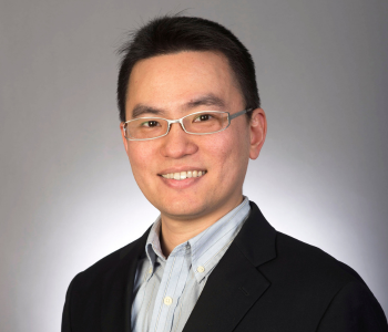
Education
Ph.D. in Water Management and Hydrological Science, Texas A&M University
M.S.L. in Studies Law, University of Pittsburgh
M.S. in Aeronautical and Astronautical Engineering, Purdue University
Teaching and Research Interests / Recent Publications or Scholarly Output
Dr. Tu’s early research focused on stormwater management and computer simulations of surface water processes on the landscape. In recent years, his research and teaching interests switched to spatial science, including GIS (Geographic Information System), satellite remote sensing, and drone remote sensing. He loves science education and is a big fan of Carl Sagan and Neil deGrasse Tyson.
Publications between 2021-2026:
Ssewanyana, A.*, Tu, M.-c. (2026). Performance of Spectral Indices and Machine Learning Algorithms in Seasonal Classification of Urban Impervious Surfaces from Sentinel-2 Imagery: A Case Study of Taipei. Remote Sensing in Earth Systems Sciences. 9(1): 16. doi: 10.1007/s41976-025-00266-9
Chen, W.-j.*, Tu, M.-c. (2025). Automated Process for Analyzing 2D CAD Floor Plan Drawings and Generating FloorspaceJS-Compatible Space Objects for Building Energy Simulations. Building and Environment. 26: 105575. doi: 10.1016/j.rineng.2025.105575
He, L., Geng, X.-w., Huo, H.-y.*, Lian, Y., Xi, Q., Feng, W., Tu, M.-c., Leng, P. (2025). Simulation of Urban Thermal Environment Based on Urban Weather Generator: Narrative Review. Urban Science. 9: 275. doi: doi.org/10.3390/urbansci9070275
Liu, C.-c., Tu, M.-c.*, Lin, J.-y., Huo, H., Chen, W.-j. (2025). Environmental Influence on NbS (Nature-Based Solution) Mitigation of Diurnal Surface Urban Heat Islands (SUHI). Remote Sensing. 17: 1802. doi: 10.3390/rs17101802
Huo, H.*, Wang, Z., Zhou, L., Liu, Z., Tu, M.-c. (2025). Wind Field Simulation and Its Impacts on Athletes’ Performance, Based on the Computational Fluid Dynamics Method: A Case Study of the National Sliding Centre of the Beijing 2022 Winter Olympics. Applied Sciences. 15: 3685. doi: 10.3390/app15073685
Tu, M.-c.*, Chen, W.-j. (2023). “Field Measurement of Dynamic Interaction Between Urban Surface and Microclimate in Humid Subtropical Climate with Multiple Sensors.” Sensors. 23(24): 9835. doi: 10.3390/s23249835
Tu, M.-c.*, Huang, Y.-c. (2023). “Impacts of Land Reclamation on Coastal Water in a Semi-Enclosed Bay.” Remote Sensing. 15(2): 510. doi: 10.3390/rs15020510
Wang, C.-p.*, Shih, B.-j., Tu, M.-c. (2021). Study on the improvement of disaster resistance against tsunamis at Taiwan’s Keelung Port. Natural Hazards. 110: 1507-1526. doi: 10.1007/s11069-021-05000-4
Nichols, W.*, Welker, A., Traver, R., Tu, M.-c. (2021). Modeling seasonal performance of operational urban rain garden using HYDRUS-1D. J. Sustainable Water Built Environ. 7(3): 04021005. doi: 10.1061/JSWBAY.0000941